
All features
Western Suite
Astrocartography
Planetary lines on a world map, with parans, local space and the lines near any city.
What you get
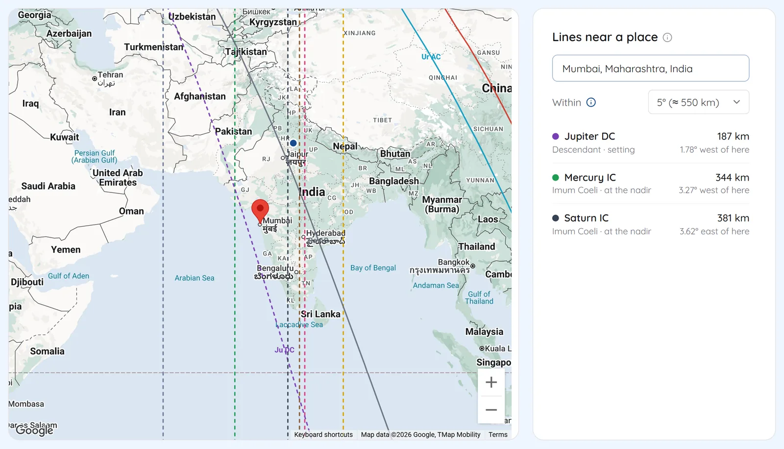
The map draws where each planet was rising, setting, culminating or on the IC at birth. Search a city to see which lines pass within your chosen orb.
- AC, DC, MC and IC lines for the Sun to Pluto, the North Node and Chiron
- In mundo or in zodiaco projection, and a true or mean node
- Parans and local space lines as overlays
- Lines near a place: search a city or click the map, and set the orb
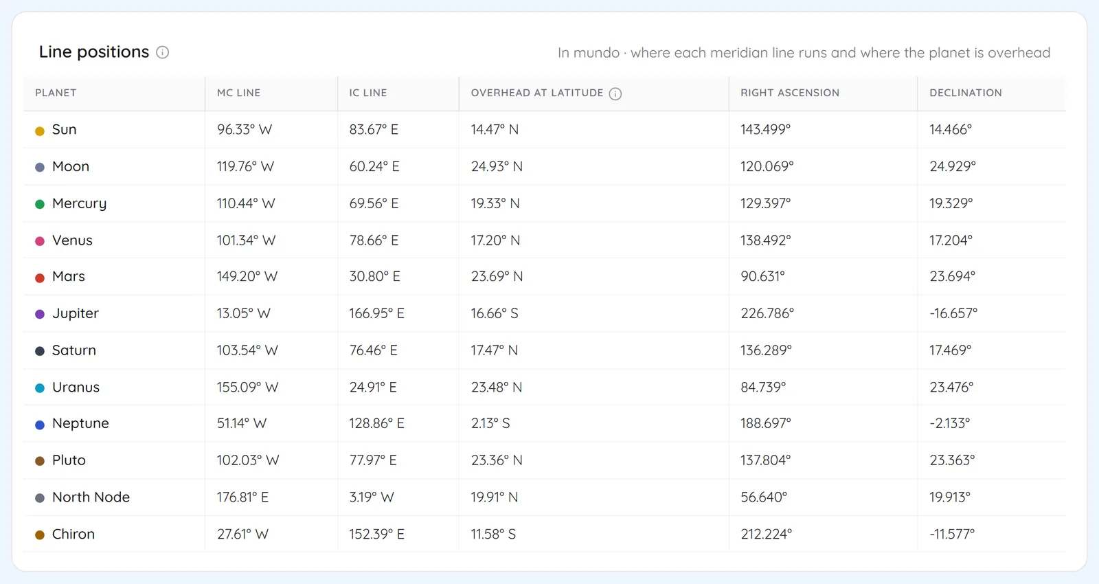
- A table of where each meridian line runs and where the planet is overhead
Screens
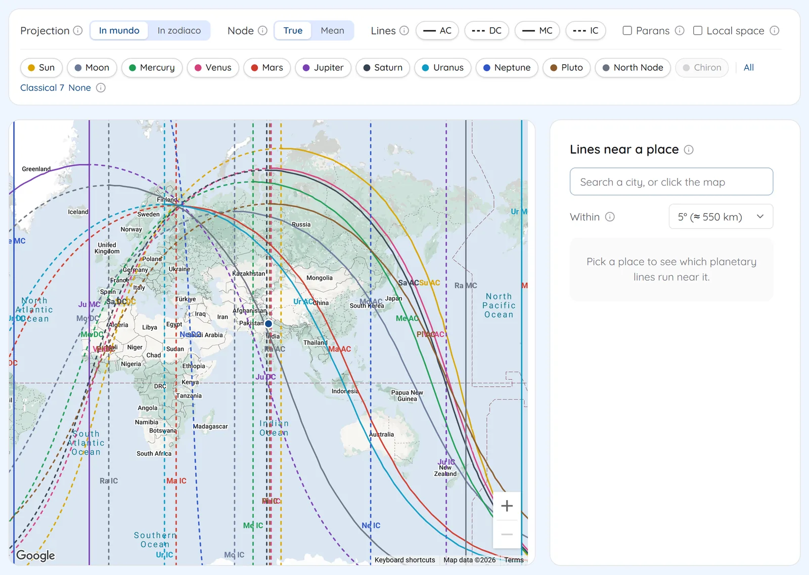
1The world mapEvery planetary line on one map, with toggles for projection, node, line type and planets. 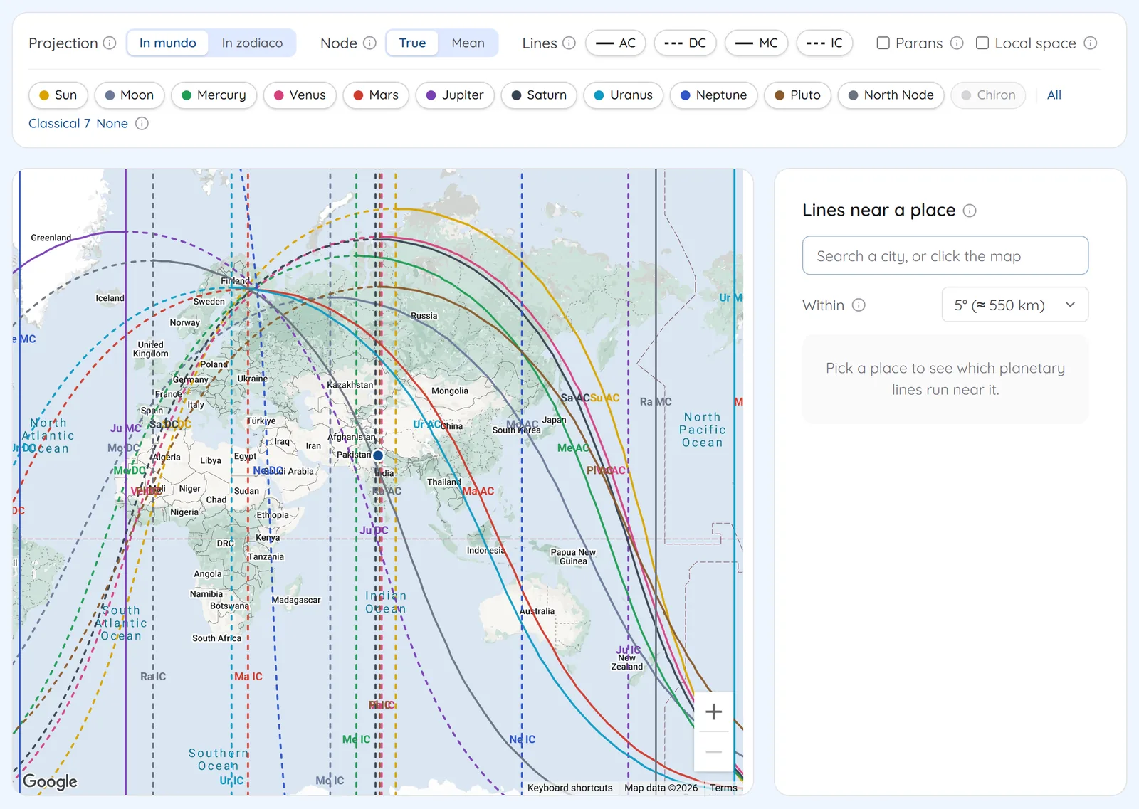
2Lines near a placePick a city and see which lines run within the orb, how far away and on which side. 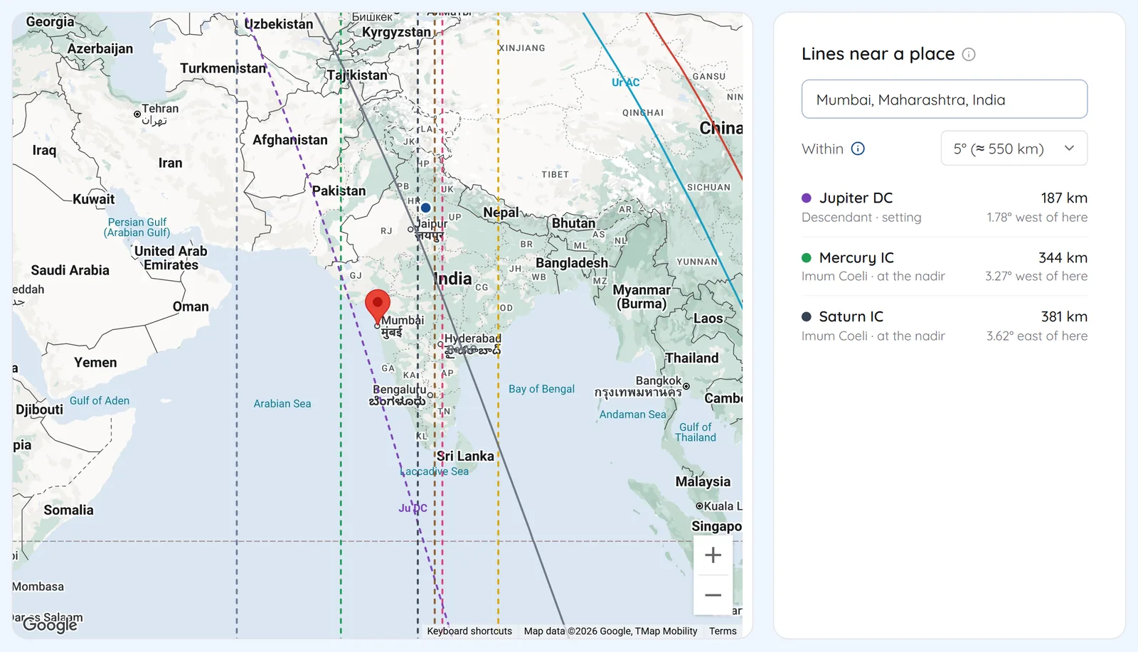
3Line positionsThe longitude of each MC and IC line and the latitude where the planet is overhead. 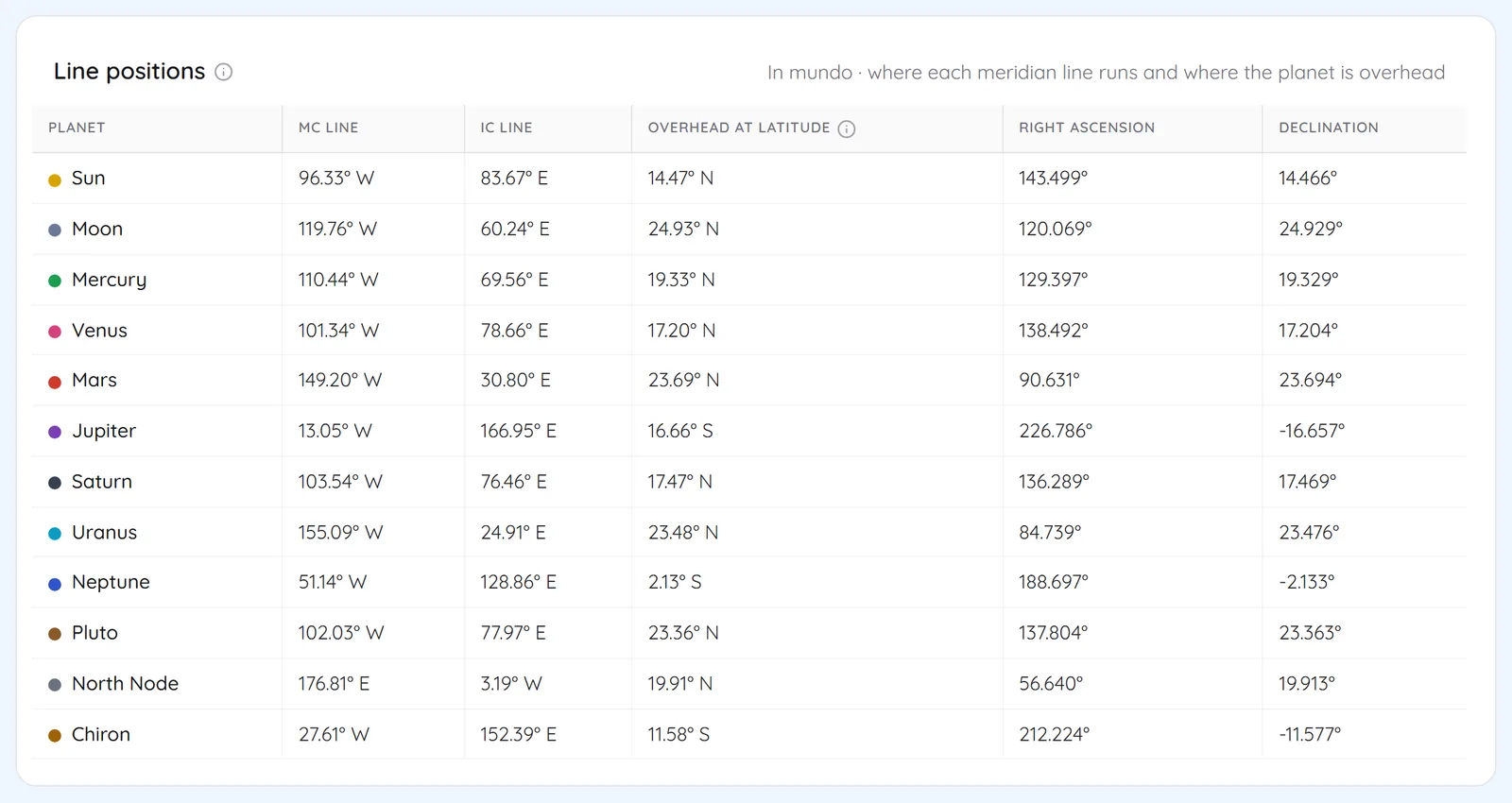
Related features
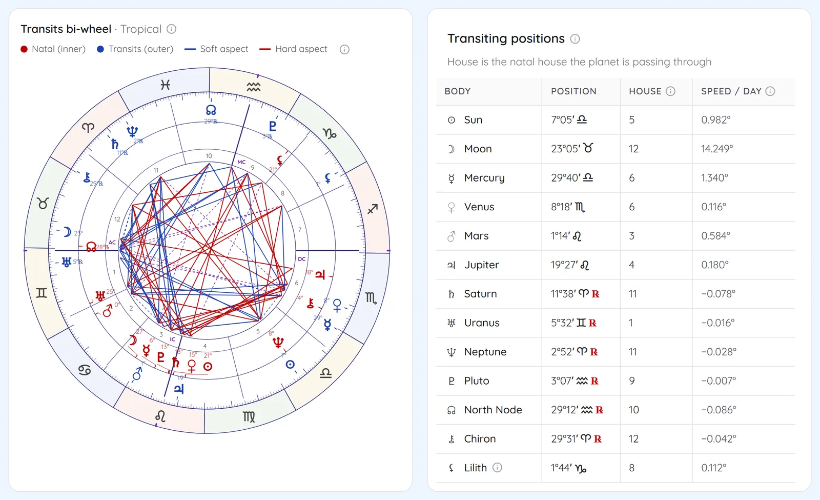 Western SuiteTransits & ReturnsBi-wheel transits, progressions, returnsSee Transits & Returns
 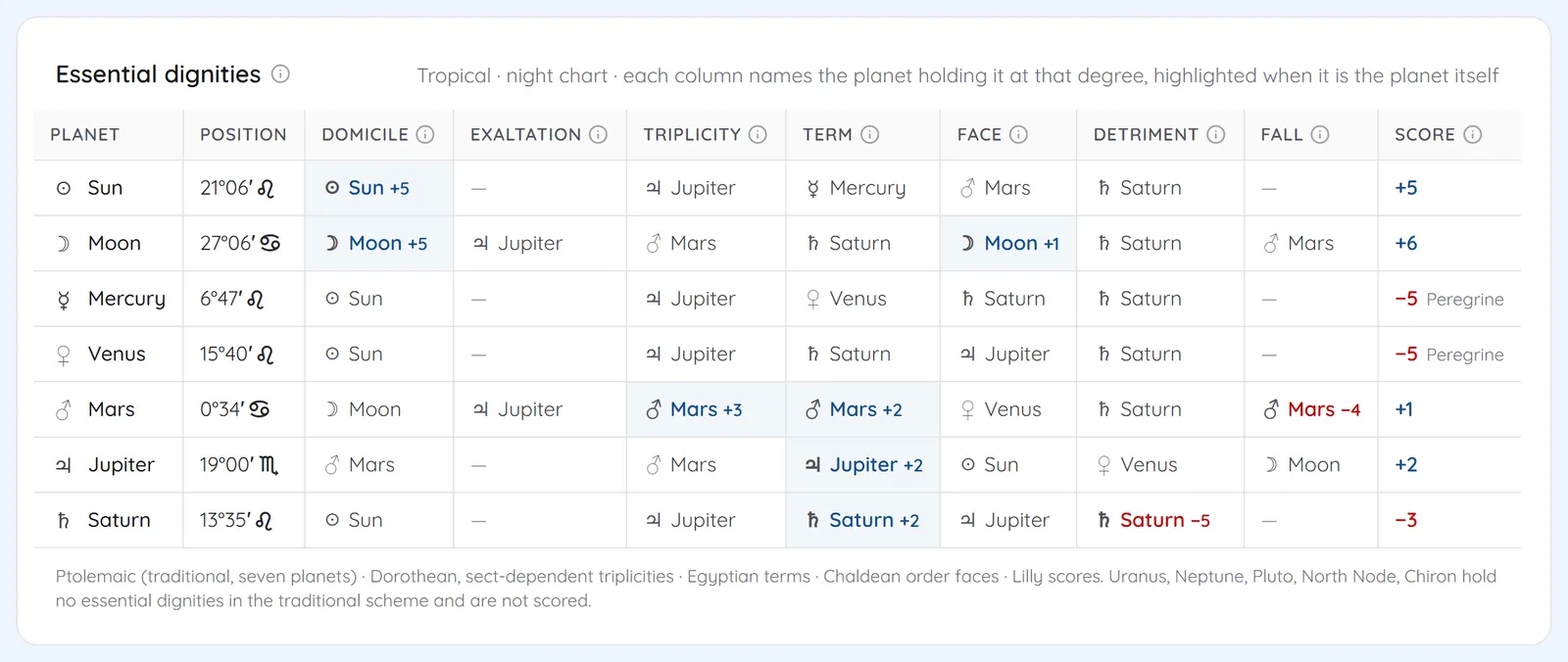 Western SuiteTraditional & Fixed StarsDignities, profections, stars; draconic and relocated chartsSee Traditional & Fixed Stars
 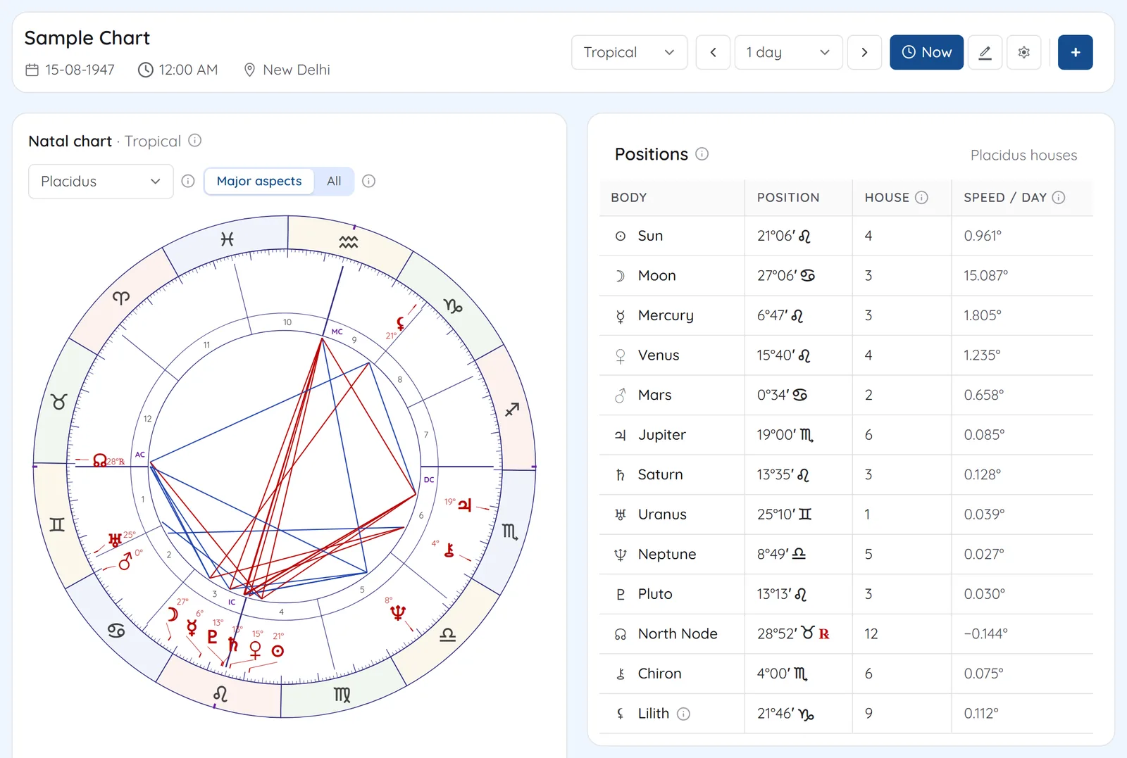 Western SuiteNatal Wheel & AspectsEight house systems and an aspect gridSee Natal Wheel & Aspects
 See Astrocartography on your own chart
7 days free on any plan. Cancel before the trial ends and you pay nothing.